Ir a contenido
Need Affirm financing? Shop at BuyDirectNYC.com → Save 3% when you pay by Zelle, Cash App, Wire/ACH or Pay by Bank. See how →
ANNOUNCEMENTS
Return Policy

We have a 15-day Return Policy

Give Us A Call

(888) 282-1350

Paying by bank? Save 3% — tap SAVE3 to copy, then paste it in the discount box at checkout.

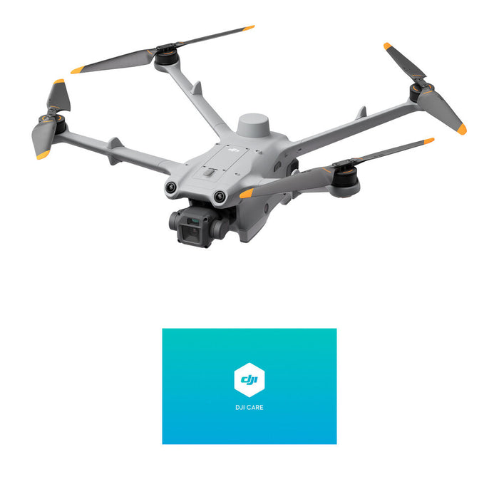
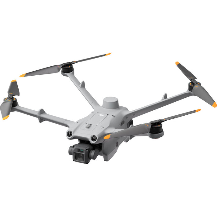
Dron empresarial DJI Matrice 3D para mapeo automatizado, inspección y seguridad

SKU DJMITSODESK
Ahorre 19 % Ahorre 19 %
Precio original $4,900.00
Precio original $4,900.00 - Precio original $4,900.00
Precio original $4,900.00
Precio actual $3,958.08
$3,958.08 - $3,958.08
Precio actual $3,958.08

El dron DJI Matrice 3D está diseñado para misiones automatizadas avanzadas y ofrece una precisión inigualable en tareas remotas de cartografía, modelado e inspección visual. Su sistema integrado de doble cámara captura impresionantes vídeos 4K e imágenes fijas de alta resolución, con el respaldo de un módulo RTK que ofrece una precisión superior. Gracias a su robusto sistema de evitación de obstáculos en seis direcciones y a su diseño resistente al polvo y al agua, garantiza un funcionamiento fiable en diversos entornos. Se integra sin problemas con sistemas basados en la nube como FlightHub 2, para una gestión integral de las misiones y un control en tiempo real.

Características principales

Captura de imágenes y precisión 
Doble cámara:
  • Matrice 3D
     cuenta con un sistema de doble cámara: una cámara gran angular CMOS 4/3 con una resolución de 20 MP y un obturador mecánico para evitar el desenfoque por movimiento durante las tareas de cartografía de alta precisión. También incluye una cámara teleobjetivo CMOS de 1/2 pulgada con una resolución de 12 MP, compatible con un zoom híbrido de hasta 56x para inspeccionar detalles desde una distancia segura.
  • Cartografía de alta precisión: El dron está optimizado para tareas de cartografía de alta precisión a escala 1:500 y puede trabajar con la plataforma FlightHub 2 de DJI para generar modelos 3D de alta precisión.
  • Módulo RTK integrado: El módulo RTK (cinemática en tiempo real) integrado proporciona una precisión de posicionamiento de nivel centimétrico, esencial para aplicaciones detalladas de cartografía e inspección.  
Rendimiento y durabilidad  Gran autonomía de vuelo: Con un tiempo de vuelo máximo de hasta 50 minutos, el 
  • Matrice 3D
     es ideal para misiones prolongadas y para cubrir áreas extensas.
  • Estructura resistente a las condiciones meteorológicas: El dron tiene una clasificación IP54, lo que lo hace resistente al polvo y al agua para un funcionamiento fiable en diversas condiciones meteorológicas.
  • Transmisión de largo alcance: El sistema de transmisión O3 Enterprise ofrece un radio de funcionamiento efectivo máximo de hasta 10 km, proporcionando una conexión estable en áreas extensas.  
Funciones autónomas y de seguridad 
Diseñado para la automatización con 
  • DJI Dock 2
    : El 
    Matrice 3D
     está diseñado específicamente para funcionar con el 
    DJI Dock 2
    , lo que permite realizar misiones de vuelo totalmente automatizadas y repetibles sin intervención humana constante.
  • Detección de obstáculos en 6 direcciones: Para mayor seguridad, el dron utiliza un sistema de visión y detección por infrarrojos en seis direcciones para detectar y evitar obstáculos desde todos los lados, excepto por detrás.
  • Operaciones basadas en la nube: A través de 
    DJI Flight Hub 2
    , los usuarios pueden gestionar tareas de vuelo, ver transmisiones en directo y procesar datos de forma remota.
  • Modos de vuelo avanzados: El dron admite modos de vuelo inteligentes como el retorno al punto de origen (RTH), la planificación automatizada de rutas de vuelo y la evasión de obstáculos.


💳 Finance This Purchase
Powered by First Citizens Bank Equipment Finance
→

Subject to credit approval. Min. $5,000 financed. 2+ yrs in business. 600+ FICO required.

STEP 1

Product Selection

STEP 2

Contact Information

STEP 3

Review Information

Dron empresarial DJI Matrice 3D para mapeo automatizado, inspección y seguridad

Enter the details below to request your custom quote in just a few minutes

Add to Wishlist
Request a Quote

Schools, government & business — tax-exempt, W-9 & NET-30 PO welcome.

Nuestros clientes y socios

Features

Fly automated missions in remote locations with the DJI Matrice 3D Drone. Matched with the required Dock 2 deployment system (not included), the Matrice 3D is designed for precision remote mapping, modeling, security, and visual inspection missions. Operators can create and manage missions with a wide variety of features as part of its cloud-based operation system. When automatically released from the Dock 2 storage container, the 3-axis gimbal and dual-camera system can capture footage at 4K30, either with a wide-angle or telephoto lens, while the integrated RTK module handles precision mapping duties. Dustproof and waterproof, the Matrice 3D can handle the elements and use its 6-directional obstacle avoidance system to automatically dodge in-flight hazards.

Matrice 3D Camera Payload

The Matrice 3D camera payload offers a wide-angle and telephoto lens that both capture video footage in 4K resolution at 30 fps. The wide-angle lens can also provide 20MP image capture, with the telephoto capable of 12MP pictures. All footage can be stored internally on an optional microSD card, with supported sizes reaching up to 512GB.

Cloud-Based Operation
Utilizing the DJI O3 transmission system, operators can pilot or manage missions from a command center up to 9.3 miles away. Primarily using DJI's FlightHub 2 software, operators can take advantage of a host of features as part of the Matrice 3D and Dock 2's cloud-based operation system.


  • Cloud Mapping: When a task (or route) is flown, FlightHub 2 can create a highly precise 3D model of the area based on internal flight data. This data can then be downloaded, annotated, and physical objects measured.
  • Flight Route Editor: When 3D models are created, operators more effectively plan missions and visually edit potential flight routes from a more realistic first-person viewpoint. This also gives the added benefit of simulating final imaging results.
  • AI Spot-Check: In a 3D model of the drone's destination, frame an area you want to capture. The Matrice 3D will then automatically compare the real area to the model selection in order to accurately capture exactly what you want. Matrice 3D can also remember that selection and capture it on repeated flights if desired.
  • FlyTo Tasks: Flight routes can be pre-planned automatically using precise 3D modeling. If pressed for time, a single click on a target can trigger the Matrice 3D to automatically select the most efficient and safest route to it.
  • Live Flight Controls: FlightHub 2 or other third-party cloud platforms give operators manual control of the drone and its gimbal via keyboard and mouse.
  • Private Deployment: Developers can use Cloud API to create a customized management system or connect to a third-party cloud platform for efficient private deployment of the Matrice 3D from the Dock 2.
  • Cloud-to-Cloud Coordination: FlightHub's Sync function can be used to link to third-party cloud platforms to manage operational data.
Additional Features
  • Up to 50 minutes of flight time
  • +/- 1.2"-accurate RTK positioning
  • 6.2-mile effective operating radius from the Dock 2
  • Support for third-party payloads, such as speakers and lights
  • Edge computing expansion support for pre-processing media files
  • DJI TerraAPI support for 2D/3D scene reconstruction, mapping, and more

UPC: 190021099821

Item Includes


  • DJI MATRICE 3D-OVERSEAS EDTN/ENTRPRS BASIC

Not Included

  • Essential
  • Drone Battery Chargers

Item Includes

Maximum Flight Time
50 Minutes
Remote ID
Yes
Camera System
Wide
20 MP, 4/3"-Type CMOS Sensor with 24mm-Equivalent, f/2.8 Lens (84° FoV)
Telephoto
12 MP, 1/2"-Type CMOS Sensor with f/4.4 Lens (15° FoV)
Show More
Maximum Video Resolution
Wide
Up to UHD 4K at 30 fps
Telephoto
Up to UHD 4K at 30 fps
Show More
Still Image Support
Wide
Up to 20 MP (JPEG)
Telephoto
Up to 12 MP (JPEG)
Show More
Sensing System
Omnidirectional (Optical Only)
Control Method
Included Transmitter
Weight
3.1 lb / 1410 g (Takeoff)
3.5 lb / 1610 g (with Maximum Payload)
Performance
Maximum Horizontal Speed
47.0 mph / 21 m/s
Maximum Ascent Speed
17.9 mph / 8 m/s
Maximum Descent Speed
13.4 mph / 6 m/s
Maximum Wind Resistance
26.8 mph / 12 m/s
Maximum Take-Off Altitude
2.5 Miles / 4000 m
Maximum Flight Time
50 Minutes
Maximum Hover Time
40 Minutes
Maximum Tilt Angle
25°
Hovering Accuracy
Vision Positioning
Vertical: ±0.3' / 0.1 m
Horizontal: ±1.0' / 0.3 m
RTK
Vertical: ±0.3' / 0.1 m
Horizontal: ±0.3' / 0.1 m
GNSS
Vertical: ±1.6' / 0.5 m
Horizontal: ±1.6' / 0.5 m
Maximum Angular Velocity
250°/s
Aircraft
Rotor Configuration
Quadcopter
Remote ID
Yes
Operating Conditions
-4 to 113°F / -20 to 45°C
Imaging
Number of Cameras
2 (Cannot Be Used Simultaneously)
Camera System
Wide
20 MP, 4/3"-Type CMOS Sensor with 24mm-Equivalent, f/2.8 Lens (84° FoV)
Telephoto
12 MP, 1/2"-Type CMOS Sensor with f/4.4 Lens (15° FoV)
Zoom
Telephoto
8x Digital
Minimum Focus Distance
Wide
3.3' / 1 m
Telephoto
9.8' / 3 m
ISO Sensitivity Range
Wide
100 to 6400
Telephoto
100 to 6400
Night Vision
No
Shutter Speed
Wide
Electronic Shutter: 1/8000 to 8 Seconds (Photo/Video)
Mechanical Shutter: 1/2000 to 1 Seconds (Photo/Video)
Telephoto
Electronic Shutter: 1/8000 to 8 Seconds (Photo/Video)
Maximum Video Resolution
Wide
Up to UHD 4K at 30 fps
Telephoto
Up to UHD 4K at 30 fps
Still Image Support
Wide
Up to 20 MP (JPEG)
Telephoto
Up to 12 MP (JPEG)
Media/Memory Card Slot
In Aircraft Body
microSD/microSDHC/microSDXC [512 GB Maximum]
Internal Storage
No
Gimbal
Number of Axes
3: Pitch (Tilt), Roll, Yaw (Pan)
Rotation Range
Mechanical Range
Yaw (Pan): 54° (-27 to 27°)
Roll: 180° (-135 to 45°)
Pitch (Tilt): 90° (-45 to 45°)
Follow Speed
Tilt: 100°/s
Stabilization Accuracy
±0.005°
Avoidance/Sensing System
Sensing System
Omnidirectional (Optical Only)
Sensing System Capabilities
Forward
Measurement Range: 1.6 to 68.9' / 0.5 to 21 m
Detection Range: 1.6 to 656.2' / 0.5 to 200 m
Max Speed: 33.6 mph / 15 m/s
Field of View: 90° (Vertical) / 90° (Horizontal)
Backward
Measurement Range: 1.6 to 75.5' / 0.5 to 23 m
Max Speed: 26.8 mph / 12 m/s
Field of View: 90° (Horizontal) / 90° (Vertical)
Lateral
Measurement Range: 1.6 to 49.2' / 0.5 to 15 m
Max Speed: 22.4 mph / 10 m/s
Field of View: 90° (Vertical) / 104° (Horizontal)
Upward
Measurement Range: 1.6 to 68.9' / 0.5 to 21 m
Max Speed: 13.4 mph / 6 m/s
Field of View: 90° (Front-to-Back) / 90° (Side-to-Side)
Downward
Measurement Range: 1.6 to 45.9' / 0.5 to 14 m
Max Speed: 13.4 mph / 6 m/s
Field of View: 95° (Front-to-Back) / 110° (Side-to-Side)
Remote Controller / Transmitter
Control Method
Included Transmitter
Transmission System
OcuSync 3.0 (O3)
Frequencies: 2.4 GHz (2.400 to 2.4835) / 5.1 GHz (5.150 to 5.250) / 5.8 GHz (5.725 to 5.850)
Mobile App Compatible
Yes: Android & iOS
App Name: DJI Pilot & FlightHub
Flight Battery
Battery Chemistry
Lithium Nickel Manganese Cobalt Oxide (LiNiMnCoO2)
Battery Capacity
7811 mAh / 115.2 Wh
Battery Configuration
4 S / 14.76 V
Maximum Charging Power
17 V
Charging Temperature
41 to 113°F / 5 to 45°C
Weight
1.2 lb / 544 g
General
GNSS Support
GPS, GLONASS, BeiDou, Galileo
Diagonal Size
18.2" / 463.2 mm
Overall Dimensions
15.7 x 6.0 x 13.2" / 398.0 x 153.0 x 335.0 mm
Weight
3.1 lb / 1410 g (Takeoff)
3.5 lb / 1610 g (with Maximum Payload)


WhatsApp