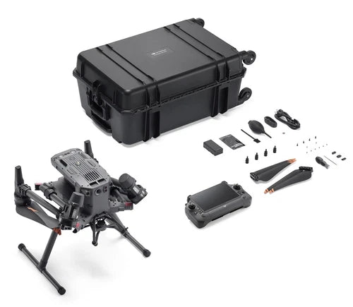

DJI Matrice 350 RTK Enterprise Drone (NO Camera/NO Battery/NO Battery Station)
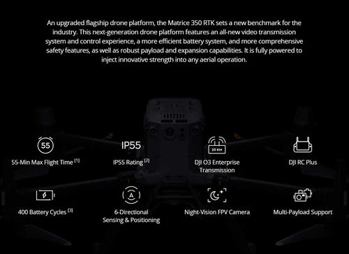
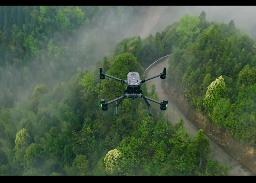
Take your aerial photography to the next level with the DJI Matrice 350 RTK Drone, featuring a maximum flight time of 55 minutes and a control range of up to 20 km. This enterprise drone is perfect for capturing stunning footage and photos. With its robust design and advanced technology, you'll be able to take your creativity to new heights. Whether you're a professional photographer or an enthusiast, this drone is sure to impress. The Matrice 350 RTK is designed to provide you with a seamless and enjoyable flying experience, allowing you to focus on what matters most - capturing life's precious moments.
Key features
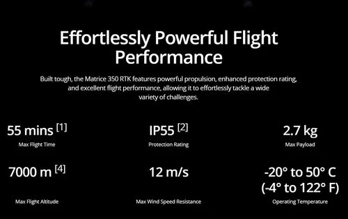
- Flight Performance
- Max Flight Time: 55 mins (no payload, with TB65 batteries)
- Max Speed: 23 m/s (82.8 km/h) in Sport Mode
- Wind Resistance: 12 m/s (Level 6)
- IP55 Rating: Dust/water resistant for harsh environments.
- Payload & Versatility
- Dual Payload Capacity: 2.7 kg (6 lbs)
- Supports Zenmuse H20N/H30T, L1/L2 LiDAR, P1 Photogrammetry simultaneously.
- Quick-Release Mounts: Hot-swap payloads in seconds.
- Precision & Navigation
- RTK Positioning: ±1 cm + 1 ppm horizontal accuracy (with D-RTK 2 base station).
- Omnidirectional Sensing: 6-directional obstacle avoidance (visual/radar).
- Smart Features
- AI Spot-Check: Automatically repositions to inspect fixed points.
- Terrain Follow: Maintains consistent altitude over slopes (up to 30°)
942476
50422846882072
DJI Matrice 350 RTK Enterprise Drone (NO Camera/NO Battery/NO Battery Station)
9805396574488
DJI Matrice 350 RTK Enterprise Drone (NO Camera/NO Battery/NO Battery Station)