
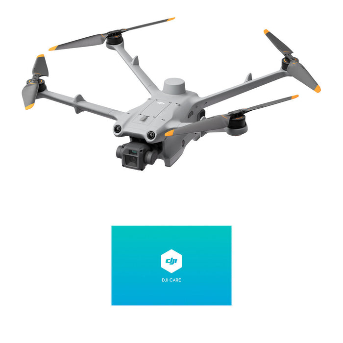
DJI Matrice 3D Enterprise Drone for Automated Mapping, Inspection, Security
SKU DJMITSODESK
Save 9%
Original price
$4,900.00
Original price
$4,900.00
-
Original price
$4,900.00
Original price
$4,900.00
Current price
$4,480.00
$4,480.00
-
$4,480.00
Current price
$4,480.00
The DJI Matrice 3D Drone is engineered for advanced automated missions, offering unparalleled precision in remote mapping, modeling, and visual inspections. Its integrated dual-camera system captures stunning 4K video and high-resolution stills, supported by an RTK module for superior accuracy. With robust 6-directional obstacle avoidance and dustproof/waterproof design, it ensures reliable operation in diverse environments. Seamlessly integrate with cloud-based systems like FlightHub 2 for comprehensive mission management and real-time control.
Key Features
Imaging and precision
Dual cameras:
-
Matrice 3Dfeatures a dual-camera system with a 4/3 CMOS wide-angle camera with 20 MP resolution and a mechanical shutter to prevent motion blur during high-precision mapping tasks. It also includes a 1/2-inch CMOS tele camera with 12 MP resolution, supporting up to 56x hybrid zoom for inspecting details from a safe distance.
- High-precision mapping: The drone is optimized for 1:500 high-precision mapping tasks and can work with DJI's FlightHub 2 platform to generate high-precision 3D models.
- Integrated RTK module: A built-in RTK (Real-Time Kinematic) module provides centimeter-level positioning accuracy, which is essential for detailed mapping and inspection applications.
Performance and durability High flight endurance: With a maximum flight time of up to 50 minutes, the
-
Matrice 3Dis ideal for extended missions and covering large areas.
- Weather-resistant build: The drone has an IP54 rating, making it dustproof and waterproof for reliable operation in various weather conditions.
- Long-range transmission: The O3 Enterprise Transmission system offers a maximum effective operating radius of up to 10 km, providing a stable connection over large areas.
Autonomous and safety features
Designed for automation with
-
: TheDJI Dock 2Matrice 3Dis explicitly designed to work with theDJI Dock 2, enabling fully automated, repeatable flight missions without constant human intervention.
- 6-directional obstacle sensing: For enhanced safety, the drone uses a six-directional vision and infrared sensing system to detect and avoid obstacles from all sides except the rear.
-
Cloud-based operations: Through
DJI Flight Hub 2, users can manage flight tasks, view live streams, and process data remotely.
- Advanced flight modes: The drone supports intelligent flight modes like Return-to-Home (RTH), automated flight route planning, and obstacle bypass.
448000
50768995713304
DJI Matrice 3D Enterprise Drone for Automated Mapping, Inspection, Security
9910462382360
DJI Matrice 3D Enterprise Drone for Automated Mapping, Inspection, Security