


Purchase Orders & Tax-Exempt
For schools, universities, government agencies, and qualified businesses — better pricing, NET-30 terms, and tax-exempt orders welcome.
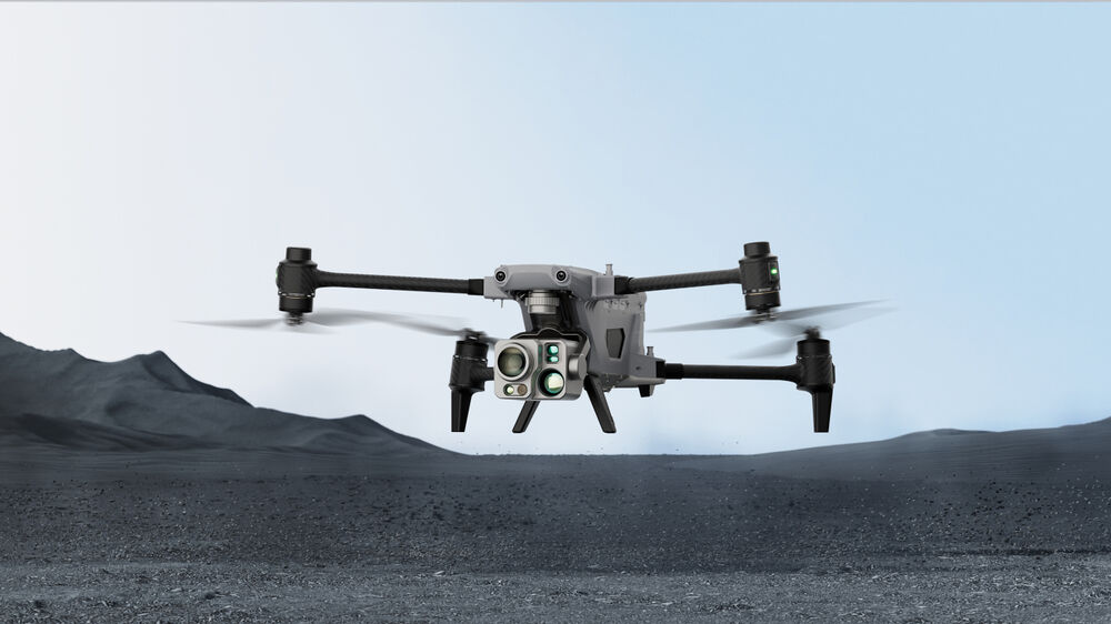
Request a quote →Autel Robotics Alpha Industrial Drone with 5-in-1 Gimbal
SKU 102002550
Save 52%
Original price
$38,998.50
Original price
$38,998.50
-
Original price
$38,998.50
Original price
$38,998.50
Current price
$18,640.45
$18,640.45
-
$18,640.45
Current price
$18,640.45
Key Features
- Visual/Thermal Wide & Tele Imaging
- Up to 1.25-Mile Laser Range-Finding
- 720° Visual & Radar Obstacle Avoidance
- Anti-Interference Technology
- A-Mesh Networking of Multi-Drone Fleets
- 4K Image & Video Capture
- Dual-Antenna RTK Millimeter Precision
- IP55-Rated Water & Dust Resistance
- Up to 40 Minutes of Flight Time
- Autel Smart Controller V3 Included
1864045
50419692699928
Autel Robotics Alpha Industrial Drone with 5-in-1 Gimbal
9803992760600
Autel Robotics Alpha Industrial Drone with 5-in-1 Gimbal


